
Dsigngo is a Graphic Design and Digital Marketing Company.
Write what you are looking for and press enter to begin your search!

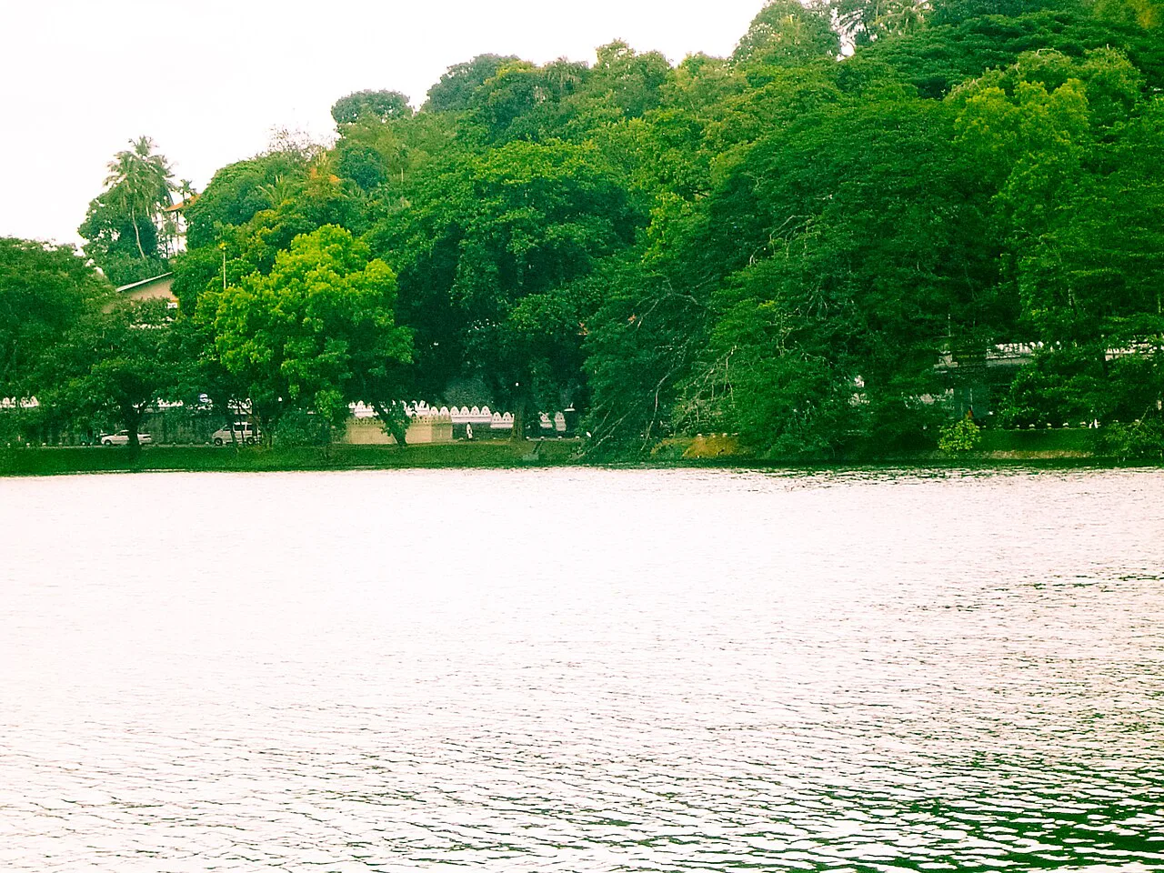
Kandy, Hill Country
Kandy Lake
Built by the last king of Kandy on the eve of his own downfall, this artificial lake was completed by executing the local chiefs who objected to the forced labour behind it.
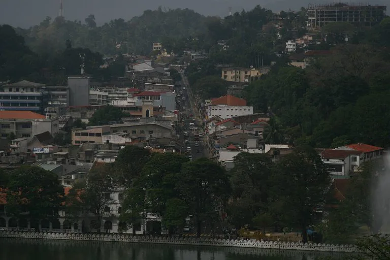
Kandy Lake looks entirely peaceful today, a shaded walking path circling still water beneath the Temple of the Tooth’s gilded roofline. Its construction, though, was one of the final acts of a king whose brutal methods helped seal his own downfall only a few years later.
Quick Facts
| Location | Central Kandy, beside the Temple of the Tooth |
| Also known as | Kiri Muhuda, or ‘Sea of Milk’ |
| Built | 1807 to 1812, by King Sri Wickrama Rajasinghe |
| Previous land use | Paddy fields known as Tigolwela |
| Size | 6,544 sq metres, up to 18.5 m deep, 3.21 km circumference |
| Architect | Deveda Moolacharya |
Commonly searched as: Kandy Lake · Kiri Muhuda · Kandy Lake history · things to do in Kandy · Temple of the Tooth lake
A Lake Built on Forced Labour
Before 1807, the low-lying ground beside the royal esplanade in front of the Temple of the Tooth was simply Tigolwela, a stretch of paddy fields containing a small pond already known as Kiri-muhuda, or “sea of milk.” King Sri Wickrama Rajasinghe, the last ruler of the Kandyan Kingdom, ordered the entire flat converted into an artificial lake, damming the Heel Oya stream and excavating the site under the direction of architect Deveda Moolacharya, intending to beautify his capital and the setting of the sacred temple beside it.
The project came at a genuinely brutal cost. Several local chiefs objected to the heavy forced labour demanded of their villagers for a purely ornamental royal project, and their resistance was treated as rebellion against the crown. According to multiple historical accounts, the protesting chiefs were executed on stakes driven into the very lake bed under construction, a punishment intended to crush further dissent. The king pressed ahead regardless, reportedly diverting funds that might otherwise have strengthened his kingdom’s defences at a moment when British pressure was mounting, a decision that, with hindsight, reads as one of several missteps that weakened his position before Kandy‘s fall in 1815.
The Unfinished Cloud Wall
Around much of the lake’s perimeter runs the Walakulu Bemma, or “Cloud Wall,” a distinctive parapet punctuated with triangular openings originally used to hold oil lamps during festivals, giving the wall’s silhouette a cloud-like appearance. Stretching 633.82 metres, the wall was never completed, work stopped abruptly partway around the lake, most likely because the escalating British threat to the kingdom left no time or resources to finish it. The unfinished Cloud Wall stands today much as it was left, an inadvertent monument to a kingdom that ran out of time.
The Island Retreat
At the lake’s centre sits a small artificial island, formed from soil removed during the dam’s construction, originally home to a pavilion called Diyatilaka Mandapaya. According to persistent local legend, the king used this secluded island as a private retreat for his royal household and the ladies of his court, hidden from public view. After the British takeover in 1815, the island’s function changed entirely: it was converted into an ammunition storage facility, with a fortress-style parapet wall added around its perimeter for security, a striking symbolic shift from royal leisure to colonial military use.
Visiting Tips
- Walk the full lakeside path, roughly 3.2 km, for views of the Temple of the Tooth, Malwatte Vihara, and the surrounding hills.
- Fishing is prohibited, keeping the lake a protected, tranquil feature of the city centre.
- Visit in the early morning or evening for the most comfortable walking temperatures and best light.
- Look for the Ulpange (Queen’s Bathing Pavilion), partially submerged along the shoreline, another remnant of the lake’s royal-era use.
A Monument to a Kingdom Running Out of Time
It’s worth sitting with the timing here. Kandy Lake was completed in 1812, just three years before the kingdom itself fell to the British in 1815. A king facing genuine, mounting external threat chose, in his final years of independent rule, to pour labour and resources into an ornamental lake rather than shoring up his kingdom’s defences, and met resistance to that choice with lethal force. Whether that reflects genuine misjudged priorities or simply the desperate symbolic gestures of a ruler who sensed his position slipping regardless of what he did, historians continue to debate. Either way, the lake stands today as one of the more physically striking reminders that Kandy’s fall wasn’t a sudden event, it was the culmination of years of internal strain unfolding in plain sight, reflected in the very geography of the capital itself.
Where It Sits on the Map
Kandy Lake, central Kandy, beside the Temple of the Tooth Open in Google Maps ↗
Frequently Asked Questions
Who built Kandy Lake and why?
King Sri Wickrama Rajasinghe, the last king of Kandy, built it between 1807 and 1812 to beautify his capital and the setting of the Temple of the Tooth.
What happened to the chiefs who objected to the project?
According to historical accounts, chiefs who protested the forced labour demanded of villagers were executed on stakes in the lake bed under construction.
Why is the Cloud Wall unfinished?
Construction was likely halted as the escalating British threat to the Kandyan Kingdom left no time or resources to complete it before the kingdom’s fall in 1815.
What is the small island in the middle of the lake?
Originally a royal retreat called Diyatilaka Mandapaya, it was later converted by the British into an ammunition storage facility with a fortified perimeter wall.
← Sri Lanka: The Complete Guide — see all 258 places by region
Related News
A guide to Sri Lanka's Hill Country: Kandy, tea plantations, Ella, Adam's Peak, Horton Plains, and travel tips.
A complete guide to Kandy: the last Sinhalese kingdom's fall in 1815, the Temple of the Tooth, Kandy Lake, and visiting tips.
A guide to St Paul's Church in Kandy: its origins in the old Royal Audience Hall, Neo-Gothic architecture, its historic organ, visiting tips and map.