

Dsigngo is a Graphic Design and Digital Marketing Company.
Write what you are looking for and press enter to begin your search!

Puttur, Jaffna Peninsula
Nilavarai Well
For generations, locals insisted this freshwater well had no bottom at all. It took a Sri Lankan Navy robotic camera expedition to finally settle the question, and even then, the answer only deepened the mystery.
Nilavarai’s Tamil name translates roughly to ‘moon-coloured pit,’ but most visitors know it simply as the Bottomless Well, a title that turned out to be more myth than measurement once the Sri Lankan Navy finally sent a robotic camera down to check.
Quick Facts
| Location | Puttur, Navakkiri GS area, about 14-16 km from Jaffna town |
| Popular legend | Created by an arrow shot into the earth (Rama seeking water for Sita, per most tellings) |
| Navy-measured depth | About 52.5 metres |
| Water composition | Fresh for the first ~18 metres, turning saline (and sulphurous) below |
| Notable feature | Never runs dry, even during severe drought |
| Possible connection | A theorised underground link to Keerimalai Springs, about 10 km away |
Commonly searched as: Nilavarai Well · Nilavarai Bottomless Well · Jaffna bottomless well · Puttur Jaffna · things to do in Jaffna
An Arrow, a Thirst, and a Well
Nilavarai’s most commonly told legend ties it directly to the Ramayana, though the details shift depending on who’s telling it: most versions describe Rama shooting an arrow into the earth to conjure fresh water for his wife Sita during their journey, while other tellings credit the demon king Ravana with piercing the ground in search of drinking water. Whichever version locals favour, the well has been treated as a place of genuine sanctity for centuries, with a shrine, the Navasaila Oswaran Kovil, built at the site, and local tradition recalling an even older cave nearby where Hindu saints once lived a life of contemplation.
Measuring the “Immeasurable”
For generations, Nilavarai’s reputation rested squarely on being genuinely bottomless, since the well never runs dry, providing fresh water for surrounding farmland even through severe drought, an achievement that felt, to those relying on it, like something beyond ordinary explanation. An early measurement by H.F. Tomlin in 1895 suggested a depth of around 44 metres, but it took a more recent Sri Lankan Navy expedition, using a robotic camera, to establish a more precise figure: approximately 52.5 metres, with the uppermost 18.3 metres holding fresh water before the water column transitions to salinity, and eventually to water carrying a distinct smell of hydrogen sulphide at greater depth.
That naval survey also uncovered something genuinely intriguing: several tunnels branching off the well at different levels, one of which is believed to connect toward Keerimalai Springs roughly 10 km away, a theory partially supported by comparative water testing suggesting a shared source, though the full extent and direction of these underground connections remains only partially understood even after formal investigation.
Geologically Genuine, Even Without the Legend
Setting the Ramayana story aside, Nilavarai is a genuine natural limestone sinkhole, formed when the upper ground layer collapsed to expose a cavern connected to underground water sources, a hydrogeological feature reflecting the same limestone bedrock that shapes several of the Jaffna Peninsula’s other unusual water features. A broken Buddha statue recovered from the well is now displayed at the Jaffna Museum, hinting at yet another, less commonly discussed layer of the site’s religious history.
Visiting Tips
- Combine with nearby Point Pedro, since Nilavarai sits conveniently along that route back toward Jaffna town.
- Look past the surface legend to appreciate the well’s genuine, still only partially understood hydrogeology.
- Take the steps down to the water’s edge for a closer look, though be mindful of the fenced boundaries in place.
- Set modest expectations for facilities on-site, and consider it a worthwhile brief stop rather than a lengthy destination.
Where It Sits on the Map
Nilavarai Well, Puttur, Jaffna Peninsula Open in Google Maps ↗
Frequently Asked Questions
Is Nilavarai Well actually bottomless?
No, a Sri Lankan Navy expedition using a robotic camera measured its depth at approximately 52.5 metres, though the ‘bottomless’ nickname persists because the well never runs dry.
What is the legend behind the well?
Most versions of the story credit Rama with shooting an arrow into the earth to find water for Sita during the Ramayana; other tellings attribute it to King Ravana instead.
Why does the well never dry up?
It’s fed by underground freshwater springs connected to a broader limestone aquifer system beneath the Jaffna Peninsula, theorised to link toward Keerimalai Springs about 10 km away.
Is the well’s water safe to drink?
The upper roughly 18 metres holds fresh, drinkable water, used for local irrigation, though it becomes saline and sulphurous at greater depth.
← Sri Lanka: The Complete Guide — see all 258 places by region
Related News
A guide to Jaffna and Sri Lanka's Northern Province: a four-century Tamil kingdom, colonial layers, post-war recovery, visiting tips and map.
A guide to the Jaffna Peninsula: its temples, ancient sites, beaches and colonial heritage, spanning Jaffna city and its surrounding villages.
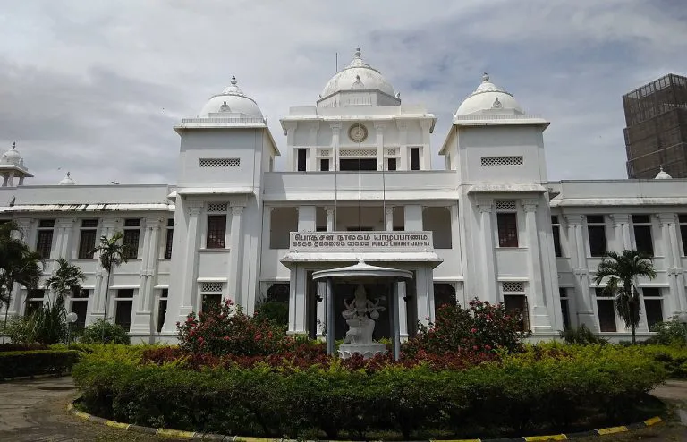
A guide to Jaffna city: capital of a 400-year Tamil kingdom, its library's destruction and rebirth, post-war recovery, visiting tips and map.